~
Magadan oblast
~
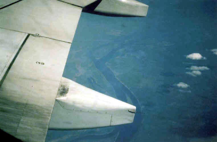
The mighty Kolyma river from 10km altitude.
[Photo: Maurice de Graaf]
![]()
Magadan oblast is an area in northeastern Russia, better known as 'the Kolyma', after the largest river flowing through the area. The history of Magadan oblast is a history of mining, since little other activity took place there. The area is literally dotted with countless mines, mostly gold mines, but there are also tin, uranium and silver mines. All the mines where operated by the Soviet labor camps, the GULags. Especially in the Stalin era millions of forced laborers where brought to the Kolyma to extract the gold from the rivers and the rocks. You could be sent here virtually at will. Common charges which led to many years of forced labor could be arriving to work 10 minutes to late, or taking a few sheets of paper from the office. Some estimates say 3 million people perished in this 'prison without walls'. After Stalin the GULags continued, but on a slightly lesser intense scale. But still many people perished in the frozen north. If you want to get a better insight into the harsh life of the forced laborer I suggest reading 'Tales from the Kolyma' by Varlam Shalamov. It is a very impressive, but easy to read piece of literature, describing camp life.
The terrain is pretty desolate and rugged with a harsh polar climate. The area is without doubt thoroughly studied, but because of the large scale mining and the secretive history in Soviet times, it is hard to come by good geological references.
Click here for a geological overview of the area
geology
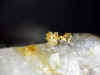
Agatovskoye is a epithermal volcanic gold-silver deposit, located in the
Cretaceous Okhotsk-Chukotka Volcanic Belt. The ores occur here in different vein
types, formed between 300 and 50°C. These are quartz veins, carbonate-quartz
veins, sulfide-carbonate-quartz veins, sulfide-carbonate veins and barite-opal
veins.
mineralogy
Acanthite Arsenopyrite Barite Chalcopyrite Galena Gold Marcasite Opal
Pyrargyrite Pyrite Quartz Sphalerite
The geochemistry of gold and it's deposits, geological survey of Canada, bulletin 280, 1979, p 414
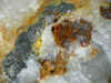
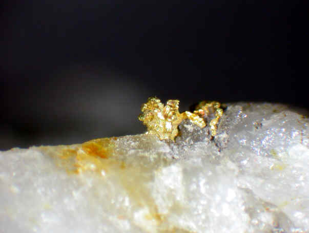
This is a horrible name in respect to transcription. The actual name should be Byoryolyokh, but so far I never saw it written this way. In Cyrillic it is written with ë what is transcribed as 'yo'. But often the dots are omitted yielding a normal e. Another point of confusion is with our friends the paleontologists. Most paleontologists will recognize Berelekh as massive mammoth graveyard. This is however Berelelekh river in northern Yakutia, close to the estuary of the Ingidirka river.
geology
Our Berelekh river flows north from Susuman. In it's bed is at least one quartz
gold deposit. Probably consisting of diorite veins cutting Jurassic sediments,
covering the Kolyma-Omolon terrane. My
sample from here has additional unidentified 'sulfides' and yellow secondary
minerals. They are most probably weathered tellurides.
mineralogy
Gold Quartz
![]()
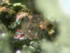
Located at the upper Chelomzha river.
mineralogy
Joseite-B Sulphotsumoite Tsumoite
click for picture of Butugychag area
![]()
A uranium mine near Ust-Omchuk. It was Russia's first uranium mine and after the Americans started detonating nukes, the Russian government made some serious effort to built a nuclear bomb themselves. Butugychag was the primary source for uranium, so the strongest prisoners where sent here. Butugychag became one of the largest GULags, but hardly anyone survived.
mineralogy
Cassiterite Uraninite
Canyonskoye is a tin deposit in the Kolyma.
mineralogy
Danburite Ferro-Axinite Fluorite Hedenbergite Malayite
Siberia's crystals and symmetry in the distribution of occurences of minerals, A.A. Evseev, World of Stones, 1/93 p19
![]()
geology
Dayka Novaya is a prospect 5km north of Susuman. It's geology is similar to that
of Svetloye. Diorite dikes cutting Jurassic sediments.
mineralogy
Gold
![]()
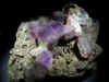
geology
Dukat is a rhodonite body with hydrothermal silver veins. The deposit is located
in the Balygachan-Sugoi depression, also known as Omsukchan depression. Which is
part of the Okhotsk-Chukotka volcanic belt. The depression consists mainly of
silt, sandstones and layers of basalt forming the Verkhoyansk Complex and the
early cretaceous coal bearing Omsukchan Formation. The ores are connected to a
rhyolitic volcanic dome. These hyperpotassic rhyolites and related rocks are divided
into three formation. The Askoldinskaya formation (84-79 m.y.) consists of
ignimbrites and rhyolites and make up the core of the dome. The Tavvatumskaya
formation (88-80 m.y.) occur outside the doe in the sills and dikes of the
ore field. The volcanics of the Nayakhanstaya formtion (76-83 m.y.) occur around
the periphery of the deposit. There are interesting micro xenoliths of Eclogite
and greenschist in the rhyolite
The main silver ores occur in associated hydrothermal veins. Apart from rich silver ores there is also lead and zinc mineralogy. The mine itself is located 35km from the settlement of Dukat. The Dukat ore field was discovered in the 1970's.
mineralogy
Acanthite Aegirine Aguilarite Albite Allanite-(Ce) Anatase Andesine Brass Corund
Fluorite Fluoroapatite Graphite Helvite Ilmenite Lead Monazite-(Ce) Pearceite Pyrophanite
Quartz Rhodonite Silver Staurolite Stistaite Sturtite Tin Xenotime-(Y) Zinc
Zincite Zircon
Metal-Bearing Basic Microxenoliths from the Nevadite of the Dukat Ore Field: Implications for the Origin of the Deposit, L. G. FILIMONOVA, 1994
A gold and silver mine in the central Magadan oblast. It is worked by the Omsukchan mining and Geological Joint-Stock Company
![]()
A now closed coal mine in the Susumanksy region.
![]()
geology
Karamken is a an open pit mine about 120 km north of Magadan.
The pit is closed and the area inaccessible. Karamken is located in the
Okhotsk-Chukotka-volcanic belt. The area consists of terrigenous Lower
Cretaceous sediments, covered by several volcanogenic formations. All this is
cut by numerous Late Cretaceous subvolcanic intrusions. Karamken deposit itself
is an old Cretaceous volcanic structure. There are many hydrothermal veins in
parts of this structure.
mineralogy
Aguilarite Berzelianite Canfieldite Chalcopyrite Franckeite Freibergite Galena
Gold Gypsum Marcasite Miargyrite Naumannite Polybasite Proustite Pyrargyrite
Pyrite Quartz Silver Sphalerite Stannite Tennantite Umangite
Ore Deposits of the USSR, V.I. Smirnov, 1977, Vol III, pp 13 -15
![]()
Kedon is a locality in the eastern part of Magadan Oblast. Geologically it consists of hydrothermal altered liparites, as sort of rhyolite. The only known mineral from here is Amethyst.
geology
Krokhalinskoye is the type locality of Kolymite and consists of hydrothermally
altered quartz porphyries.
mineralogy
Antimonite Arsenopyrite Berthierite Copper Gold Kolymite Pyrite Quartz
A gold and silver mine 600 miles north of Magadan. It is worked by the Omolon gold mining company.
geology
The Lunny mine is located 50km north of Dukat. It is a combined open pit and
underground gold-silver mine. Geologically the Lunny ore field consists of
andesitic volcanic rocks, various granitic and granodioritic intrusions and
Mesesoic carbonaceous sand- and siltstones.
Matrosov mine
(Natalkinskoye, Natalka)
geology
This gold-silver mine is located just west of Omchak. The deposit consists of
permian sedimentary rocks intruded by a late Cretaceous-early Jurassic granitoid
massif.
mineralogy
I have no data on specific minerals here, but there should be gold, silver and
PGM minerals present here.
geology
The Nadezhda mining district is located about 85km north of Sinegorye. It is a
granodiorite intrusion in Jurassic argillite and siltstone.
mineralogy
Gold
![]()
The Nevskoye mine is located close to the village of Omsukchan.
mineralogy
Arsenopyrite Babkinite Bismutite Brochantite Cosalite Cyanotrichite Enargite
Guanajuatite Hubnerite Laitakarite Nevskite Stannite Tetrahedrite Weibullite
Wittite
![]()
A now closed coal mine close to Omsukchan
located in the Kolyma highland
mineralogy
Siver (as alluvial nuggets)
Shkolnoye
geology
Shkolnoye, named this way because the deposit was discovered by school children,
consists of gold bearing quartz veins. The deposit is located 60km from Omchak.
mineralogy
Gold Quartz
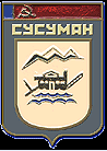
Heraldy of Susuman with gold dredge
![]()
Susuman is a relative large town in central Kolyma. The surrounding rivers where one of the main sources of placer gold during the GuLAG years from 1937 onwards. Only from 1970 the surrounding primary gold sources are mined like Berelekh and Svetloye.
mineralogy
Gold
geology
Svetloye is located 12km southwest of Susuman. The country rock consists of
Jurassic shale, siltstone and sandstone cut by diorite dikes and quartz veins.
THe vains are maine epithermal quartz-albite-adularia veins.
mineralogy
Albite Arsenopyrite Galena Gold Quartz Scheelite
![]()
An open pit coalmine in the Susemansky region. The mine recently closed down due to the decreasing demands of coal in the region.
Located near Omsukchan, Tidit is a epithermal polymetallic-silver deposit.
mineralogy
Diaphorite
geology
The Topka mine is a placer mine in the Dukat district. The gold mined here
originated from quartz-calcite veins in triassic mudstone and siltstone.
geology
Urutukan is a gold sulphide vein in the Kolyma. It was described by Bilibin in
1935 in Problemy Sovetskoy Geologiya.
mineralogy
Arsenopyrite Galena Gold Pyrite Sphalerite Tennantite
Ushelny mine
geology
The Ushelny mine is a Quartz-Adularia-gold vein deposit 15 km north of Karamken.
(~130km north of Magadan). It is a small gold silver deposit
mineralogy
Gold Quartz
geology
The Utinski deposit is little known today. It is mentioned by Pedachenko in
1936.
mineralogy
Arsenopyrite Boulangerite Gold Quartz
![]()
geology
Located south of the settlement of Sejmchan. Verkhne Sejmchan is one of the
world's few cobalt dominant hydrothermal deposits. Geologically it is located at
the Northern portion of the Balygychan uplift. The country rock is middle
Jurassic sedimentary rock (sandstones, shales and conglomerates) deposited on
the basement of the Archean Kolyma-Omolon super terrane. In the upper Cretaceous
granitoids intruded into these sedimentary rocks. These granitoids and accompanying
diorite dykes formed the first phase of mineralisation, depositing
minerals like titanite, rutile and xenotime. Subsequent high temperature
hydrothermal activity deposited the main cobalt and sulfide mineralogy.
mineralogy
Albite Anatase Arsenopyrite Bismuth Brookite Calcite Chalcopyrite Clausthalite
Cobaltite Elbaite Epidote Ferro-Axinite Fluorite Fluoroapatite Galena
Gersdorffite Glaucodote Guanajuatite Hessite Krennerite Marcasite Millerite
Proustite Pyrargyrite Pyrite Pyrrhotite Quartz Rutile Silver Skutterudite
Sphalerite Stannite Tetradymite Titanite Xenotime-(Y) Zircon Zoisite
Ore deposits of the USSR, V.I. Smirnow, 1977, Vol II, pp83-87
references
Kolyma Golden Ring, a tour of the Russian Far East, by M. D.
Balen and J.Y. Foley. (http://imcg.wr.usgs.gov/usbmak/mej1.html)
Magadanjew.ru has an interesting
survey of 209 GULags with maps.