Monchegorsk
![]()
Monchegorsk means something like 'Beautifull Tundra'. Times have obviously changed, because Monchegorsk is one of the most heavily polluted areas in Russia. The town of Monchegorsk is located on the west coast of Lake Imandra, along the Kandalaksha-Murmansk highway. As the coat of arms above already reveals Monchegorsk is a town of nickel, cobalt and copper mining and smelting. The prospecting and mining operations took mainly place between 1930 and 1970. Today there is renewed interest in the platinum group minerals (PGM) and chromite ore.
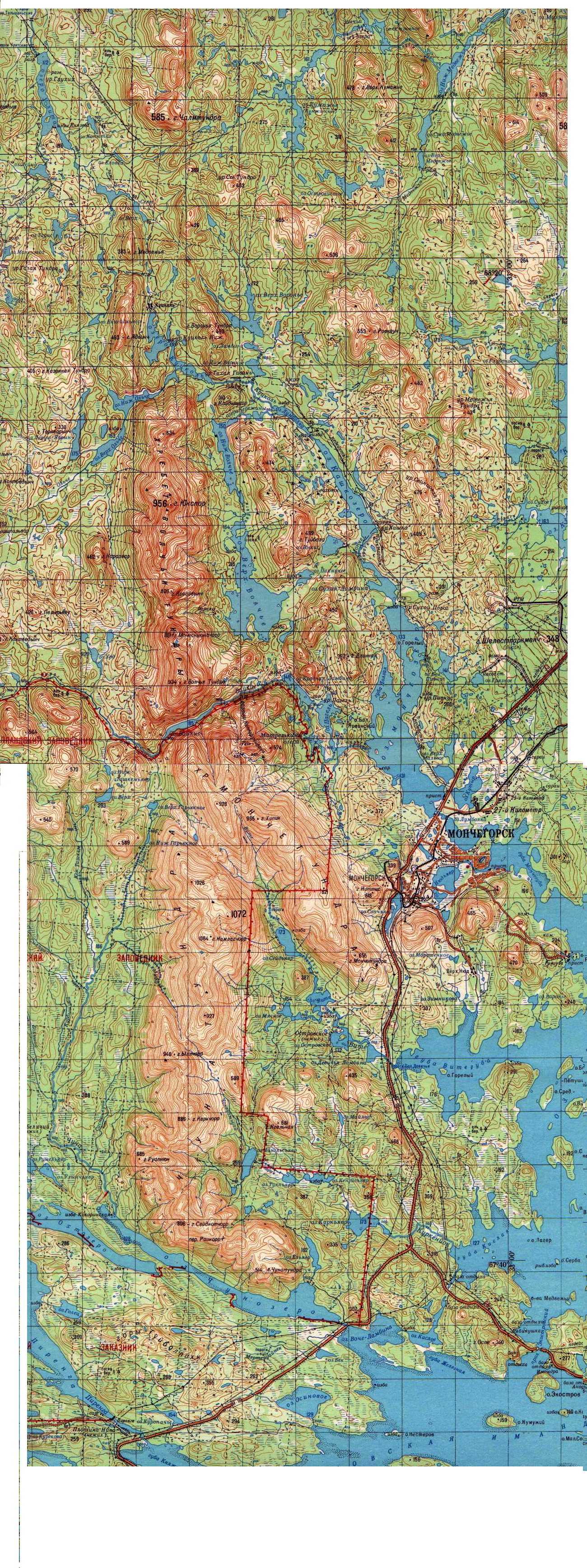
click on the map to download
Geology
The locality we use to call simply 'Monchegorsk' is in reality more complex.
'Monchegorsk' consists of two different intrusions adjacent to each other. The Monchegorsk intrusion and the Monchetundra intrusion make up the Monchegorsk
magmatic complex or MMC. A third massif the Vuruchuaivench massif, is a gabbro
norite massif bordering to the southeast to the Monchegorsk pluton. Between the
Monchegorsk and Monchetundry intrusions lays a so called boundary zone, which is
also rich in minerals. The entire MMC is located right at the edge of the Kola
terrane (one of the archaen blocks of Kola). In this area the Kola terrane
consists of late archean biotite gneiss and amphibole-biotite gneiss. On the southeast the Vuruchuaivench
complex borders the volcanosedimentary rocks of the Imandra-Varzuga rift.
The Monchegorsk pluton has an age of around 2500 Ma. The Monchegorsk pluton is a layered, or differentiated pluton and consists of the main layers. The upper layer consists of gabbronorite and gabbroanorthosite. Below this layer is a middle zone of pyroxenite, olivine pyroxenite, plagiopyroxenite, norite and gabbronorite. The deepest layer contains dunite, poikilitic peridotite and pyroxenite. The two lower layers have a thickness of about 300 meters, white the upper layer has a thickness of about 1 kilometer. A more detailed description of the layers can be found in Neradovsky (See below). The Monchegorsk intrusion manifests itself above surface in a number of hills. These are named: Nittis, Kumuzhja, Travyanaya, Sopchuaivench, Nyuduaivench and Poazuaivench. These are frequently abbreviated as Sopcha, Nyud and Poaz
The Monchetundry pluton is slightly younger with 2450 Ma. It consists of gabbro, gabbronorite, pyroxenite, peridotite and anorthosite.
The Vuruchuaivench massif consists of gabbronorite.
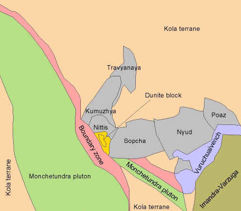
Main geological units [Maurice de Graaf, simplyfied from Grokhovskaya et al]
mineralogy
The list of minerals below is a total list (not necessarily complete) of all
intrusions in the MMC and the boundary zone. Not all minerals occur in all
intrusions as far is yet known. Most minerals are only visible in ore
microscopy.
The mineralogy occurs syngenetic as grains or blebs throughout the rock, but also epigenetic in veins
Altaite Bornite Braggite Calaverite Calcite Chalcopyrite Chromite Cooperite Covellite Cubanite Gold Hematite Hessite Hollingworthite Ilmenite Imgreite Irarsite Iridium Kotulskite Mackinawite Magnetite Marcasite Melonite Merenskyite Michenerite Millerite Molybdenite Moncheite Morenosite Nickelhexahydrite Nickeline Niggliite Osmium Palladoarsenide Pentlandite Polydymite Pyrite Pyrrhotite Quartz Sopcheite Sperrylite Sphalerite Stannopaladinite Sylvanite Tarkianite Tremolite Tucekite Valleriite Violarite Vysotskite
Also reported is Guanglinite which is possibly the same as Isomertieite. The Cobaltine is often Pd rich.
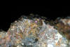 Chalcopyrite |
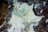 Nickelhexahydrite |
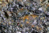 Pentlandite |
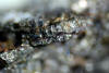 Pyrrhotite |
references
PGE mineralisation in the Paleoproterozoic Monchetundra Layered Igneous
complex. by Tatiana Grokhovskaya et al
The Monchegorsk Layered Complex and related Mineralization. by Yu. N. Neradovsky et al
Ore Deposits of the USSR, V.I. Smirnov, 1977, Vol II, p25-29